Mapit GIS - Map Data Collector


توضیحات Mapit GIS - Map Data Collector
Mapit یک ابزار حرفه ای، مستقل، مقرون به صرفه و نقشه برداری است که برای افزایش بهره وری طراحی شده است، در حالی که شما در این زمینه هستید.
این نرم افزار از فرمت فایل های رایج برای ورودی و خروجی پشتیبانی می کند و قادر به کار با تعداد گیرنده های GNSS خارجی است، بنابراین شما می توانید دقت سطح سانتیمتر را هنگامی که نیاز دارید دریافت کنید.
فرم های نظرسنجی خود را طراحی، سازماندهی داده ها در لایه ها، کار آفلاین با mbtiles base-maps، دسترسی به خدمات WMS، استفاده از ردیابی GPS برای ضبط خطوط و ویژگی های چند ضلعی، ضبط ابرداده های GNSS و خیلی بیشتر برای کشف.
برنامه به طور گسترده ای توسط متخصصان در سراسر جهان مورد استفاده قرار می گیرد و می تواند به راحتی برای برنامه های کاربردی مختلف از کشاورزی و جنگلداری به ساخت جاده ها، زمین شناسی، نقشه برداری زمین و راه حل های پنل پنل استفاده شود. تنظیمات شخصی و انعطاف پذیری باعث می شود این برنامه مناسب ابزار مورد نظر باشد که جریان کار نقشه برداری شما را افزایش می دهد.
برنامه همچنین می تواند به عنوان یک ابزار اندازه گیری برای محاسبه نقاط یا فاصله استفاده شود.
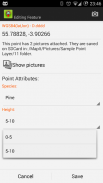
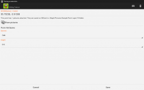
هنگام صرفه جویی در محل به سادگی ویژگی های مورد نیاز از لیست کشویی از پیش تعریف شده را انتخاب کنید، بدون نیاز به تایپ همان اطلاعات بارها و بارها. وارد کردن لیست طولانی از صفات از فایل های متنی و استفاده مجدد از آنها در تعدادی از پروژه ها. در صورت لزوم میتوانید تصاویر را به هر مکان اضافه کنید.
اگر در این زمینه کار می کنید، جمع آوری مقدار زیادی از اطلاعات فضایی این برنامه برای شما طراحی شده است.
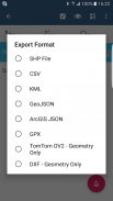
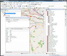
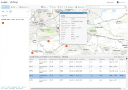
سرعت گردش کار خود را افزایش دهید و جمع آوری داده ها را موثرتر کنید. استفاده از لایه های بررسی و امکان استفاده دوباره از ویژگی های مشابه برای چندین نظرسنجی. داده های خود را به فرمت های رایج GIS مانند Esri shapefiles، CSV، KML، geojson، DXF، GPX و داده های خود را با استفاده از نرم افزار Desktop GIS مانند qGIS پردازش کنید.
پشتیبانی از تعدادی از سیستم های مختصات از پیش تعریف شده و کدهای EPSG سفارشی در صورت لزوم.
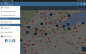
ویژگی های مجموعه داده موبایل:
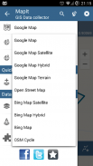
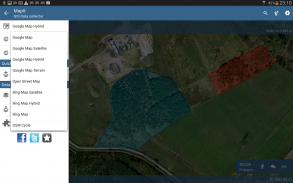
- نقشه های پایه: انتخاب آنلاین نقشه آنلاین محبوب و mbtiles آنلاین،
- پشتیبانی از RTK اصلاح مختصات هنگامی که بلوتوث GPS / GNSS خارجی متصل است،
- پشتیبانی از سرویس WMS و GIS خدمات نقشه برداری کاشی - بارگیری نقشه های توپوگرافی و ارتوفوتو، نقشه برداری های زمین شناسی، اطلاعات کابالیستی و تعدادی از خدمات دیگر.
- امکان ایجاد و نگهداری مجموعه ای از ویژگی ها - هنگامی که ویژگی های جدید در حال ضبط هستند، این لیست ها به عنوان لیست کشویی در دسترس هستند، لیست های طولانی از مقادیر را می توان از فایل های متنی وارد کرد.
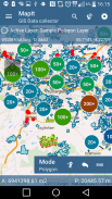
- خوشه بندی برای اشاره گر نقشه نقطه، روش کارآمد داشتن تعداد زیادی نقاط در نقشه بدون مسائل مربوط به عملکرد،
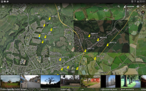
- در حال حاضر 4 روش جمع آوری پشتیبانی می شوند (موقعیت GPS / GNSS، محل مکان نما مکان، ردیابی، ریزش نقطه با استفاده از زاویه و فاصله)
- امکان جمع آوری اطلاعات خود را به لایه های نظرسنجی - هر لایه نظرسنجی ممکن است مجموعه ای از ویژگی های پیش فرض داشته باشد.
- کارت SD محلی یا صادرات از راه دور. در حال حاضر پشتیبانی از پوسته ها، KML، CSV، geojson، GPX و DXF پشتیبانی می شود.
- صادرات مستقیم به مکان Dropbox یا FTP
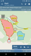
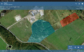
- امکان ضبط چندین نقطه، خطوط و چند ضلعی در یک لایه
- هنگام ایجاد ویژگی های چند ضلعی جدید و یا خط ویژگی های اندازه گیری مانند منطقه و یا طول نیز در دسترس هستند.
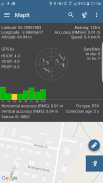
- موقعیت GPS / GNSS و ماهواره ها
- آدرس، جستجوی مکان،
- ویژگی های واردات، خط و چند ضلعی را به لایه از فایل های CSV، KML، shapefile یا geojson،
- مدیریت پشتیبان گیری
- ویژگی های واردات / صادرات از فایل و خیلی بیشتر برای کشف ...
کاربران ما با موفقیت با استفاده از Mapit در تعداد برنامه های کاربردی از جمله:
- نظرسنجی محیط زیست و جنگل،
- برنامه ریزی جنگلداری و مدیریت جنگل،
- طبقه بندی کشاورزی و خاک و نمونه برداری،
- سازه های جاده ای،
- نقشه برداری زمینی،
- برنامه های کاربردی پانل های خورشیدی
- سقف و شمشیربازی
- نظرسنجی درخت،
- نقشه برداری GPS و GNSS،
- نقشه برداری سایت
- برف روبی
دریغ نکنید با ما تماس بگیرید به طور مستقیم و یا با استفاده از فرم تماس در وب سایت ما.
Mapit GIS - Map Data Collector - نسخه 7.8.0.0Core
(16-08-2021)

Mapit GIS - Map Data Collector - اطلاعات APK
نسخه APK: 7.8.0.0Coreحزمة: com.osedok.gisdatacollectorآخرین نسخه Mapit GIS - Map Data Collector
سایر نسخهها


اپلیکیشنها در دسته مشابه

شاید دوست داشته باشید...